Parish Boundary Anomaly – Pant y Abad
Flintshire, approx. 4 miles SE of Prestatyn
OS Reference SJ 106788 / N 53.298825 & W -3.343416
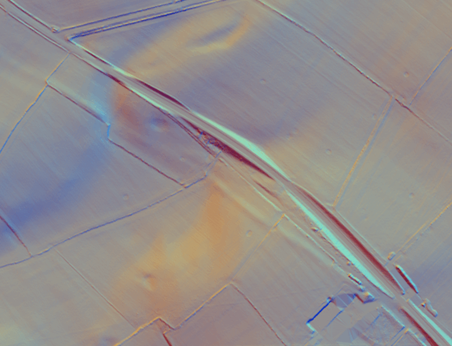
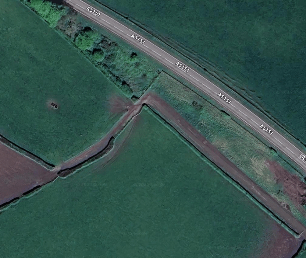
A parish boundary running approximately East – West, between the parish of Whitford to the South and the parish of Trelawynd & Gwaenysgor to the North, crosses Offa’s Dyke. In the middle of the Dyke, as marked on 1:25,000 OS 265 Clwyidian Range, the parish boundary takes a sharp, brief Northerly turn before continuing on its prior running direction, and immediately joining another parish boundary, Llanasa.
The parish boundary is demarcated by a hedge; at the anomaly, the hedge turns – the curve is distinct – and crosses a farm track, before continuing on its prior running direction.
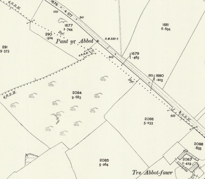
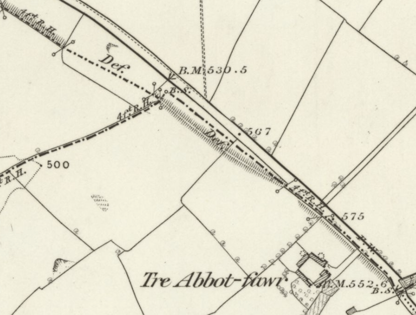
Interestingly, on the 1910 Twenty Five inch map, it looks as if the anomaly is in the Llanasa parish boundary; running down from the NW it appears to describe a brief sharp turn to the North East before continuing on its prior running direction. On the 1870 Six Inch Map, the parish boundary, running mid way down the centre of the bank of Offa’s Dyke, appears to ‘step’ off the bank to a boundary stone, before regaining the centre line of the bank.
The bank of the dyke is visible on the LIDAR imaging of the site.
Open Street Map
https://www.openstreetmap.org/#map=17/53.299171/-3.343792

Google Maps – Satellite View
https://www.google.com/maps/@53.2994038,
3.3424106,162m/data=!3m1!1e3?entry=ttu&g_ep=EgoyMDI1MDQxNC4xIKXMDSoJLDEwMjExNDU1SAFQAw%3D%3D
National Libraries of Scotland – Boundaries Viewer

National Libraries of Scotland
OS Twenty-Five Inch Map, Flintshire V.2 Revised: 1910, Published: 1912
https://maps.nls.uk/view/135195241
National Libraries of Scotland
OS Six Inch Map, Flintshire Sheet V Surveyed: 1870 to 1871, Published: 1878
https://maps.nls.uk/view/102342342
National Libraries of Scotland
Georeferenced View – LIDAR 0.5 to 1.0m DTM
https://maps.nls.uk/geo/explore/#zoom=17.0&lat=53.29964&lon=-3.34238&layers=6&b=LIDAR_DTM_1m&o=0